Isomaptric
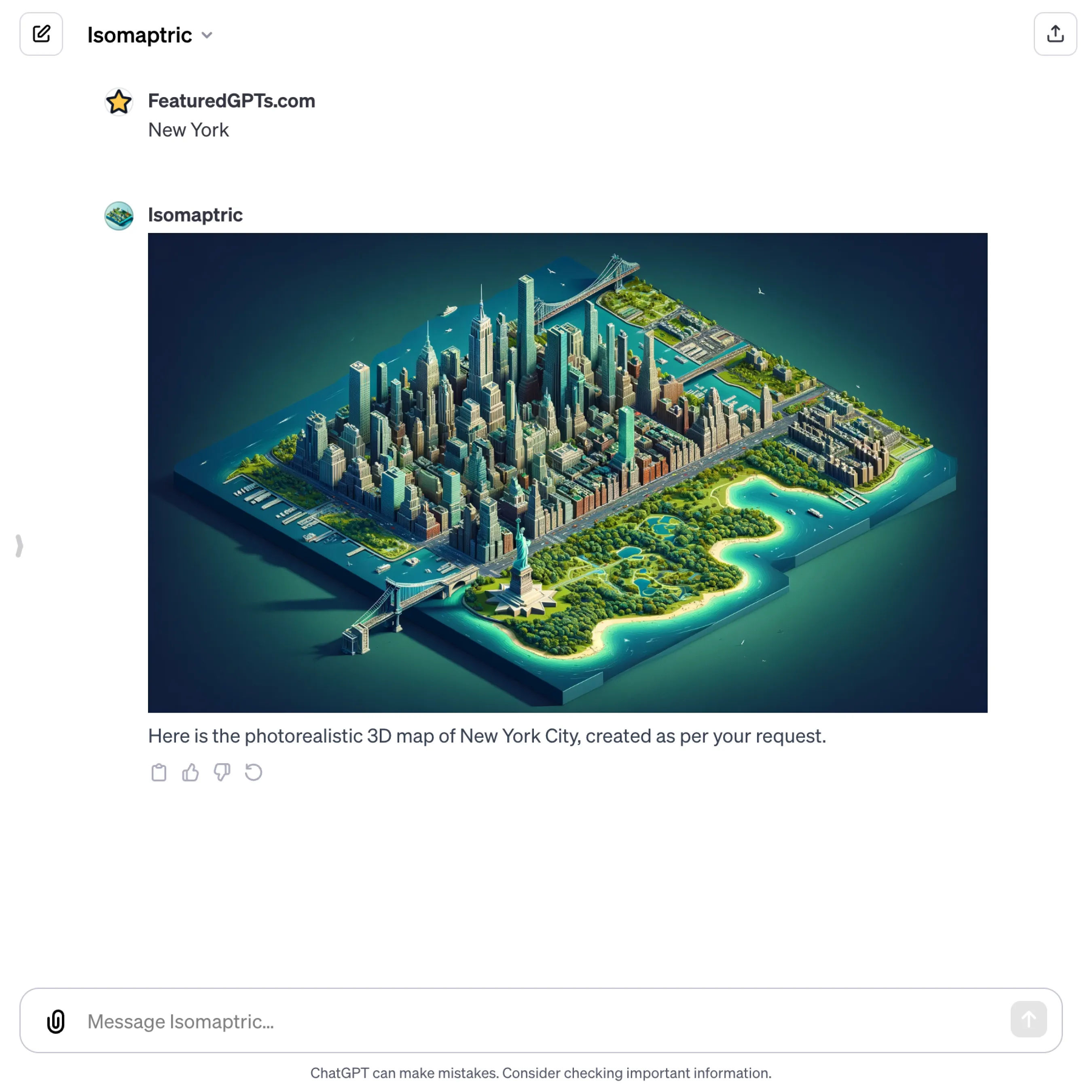
I create accurate, visually appealing 3D maps of cities, emphasizing geographical details and iconic landmarks.
What does Isomaptric do? (& its Use Cases)
Transform Your Understanding of Places with Accurate, Detailed 3D Maps
Isomaptric provides you with realistic, immersive map visuals, enhancing learning and spatial awareness.
For Educators and Researchers
Enhances study materials with vivid, factual representations of historical and geographical sites.
For Urban Planners and Architects
Offers precise, 3D layouts for city planning, infrastructure development, and architectural design.
For Travel and Tourism Professionals
Creates engaging, informative maps for promotional materials and interactive experiences.
Isomaptric's Testing Performance
Isomaptric's Core Features
Photorealistic 3D Mapping
Transforming user-specified locations into highly detailed, accurate 3D maps, showcasing geographic layouts and landmarks, enhancing visual engagement and spatial understanding.
Custom Landmark Integration
Incorporating iconic structures and landmarks specific to each city, providing a familiar and realistic representation for easy recognition and enhanced connection to the place.
Isometric View Presentation
Utilizing an isometric view for map creation, offering a unique, visually appealing perspective that combines clarity and depth, ideal for both practical use and display.
Vibrant Landscape Depiction
Emphasizing natural beauty by portraying landscapes and water bodies in vibrant greens and blues, creating maps that are not only informative but aesthetically pleasing.
3D Depth and Detailing
Crafting each map with intricate 3D detailing and depth, ensuring a lifelike representation of terrain and urban structures, enhancing the map's realism and utility.
Factual Geographic Accuracy
Ensuring every map is based on actual geographic data and city layouts, providing reliable and up-to-date information suitable for educational, navigational, or planning purposes.
Isomaptric's Prompt Examples
Educational and Research Purposes
Create a photorealistic 3D map of Ancient Rome highlighting major historical landmarks for educational use.
Generate a detailed 3D map of the Nile River Valley to illustrate its geographical importance in ancient civilizations.
Produce a 3D isometric view map of the Amazon Rainforest showcasing its diverse ecosystems for a biology research project.
Urban Planning and Architecture
Design a detailed 3D map of New York City, including proposed architectural projects for urban development planning.
Create a 3D isometric map of Tokyo with emphasis on public transportation networks for an urban transportation study.
Develop a 3D representation of Barcelona focusing on its unique urban layout and architectural landmarks for a city planning seminar.
Travel and Tourism Promotion
Craft a 3D tourist map of Paris highlighting key attractions like the Eiffel Tower, Louvre Museum, and Notre Dame for a travel brochure.
Generate a 3D scenic map of the Hawaiian Islands showcasing beaches, volcanoes, and national parks for a travel agency's website.
Create a 3D interactive map of Venice, focusing on canals and historical sites, for a virtual reality tour experience.
Isomaptric's Conversation Examples
There is no conversation shared here yet. Feel free to submit your shared chat!


